All Works
→ Stable
·
68 sales
Typical price ~
🔒
Most sales ~
🔒
Major works ~
🔒
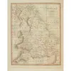
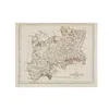
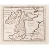
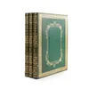
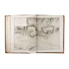
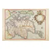
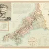
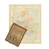
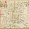
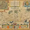
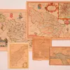
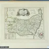
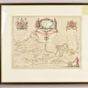
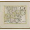
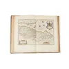
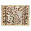
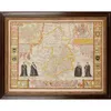
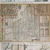
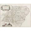
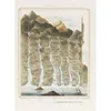
England's most famous early mapmaker, Speed's county maps from the Theatre of the Empire of Great Britain are perennially popular with collectors. English text on the verso, original hand colouring and the charming town plans inset in the corners all add to their appeal and value.
Full Sales History
68 sales
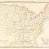
Cary, JohnCary's New Map of England and Wales with part of Scotland
Lyon & Turnbull
28 Feb 2026
🔒
Cary, John [New and Correct English Atlas]
Lyon & Turnbull
28 Feb 2026
🔒

Jeppe, F. - C.F.W. JeppeMap of the Transvaal or S.A. Republic and Surrounding Territories
Lyon & Turnbull
28 Feb 2026
🔒
MacFarlane, WilliamA Plan of the Ancient Town of Perth
Lyon & Turnbull
28 Feb 2026
🔒
Camden, William Britannia Abridg'd
Lyon & Turnbull
28 Feb 2026
🔒
Carne, JohnSyria, The Holy Land & Asia Minor
Lyon & Turnbull
28 Feb 2026
🔒
Wyld, James, publisherMaps & Plans Showing the Principal Movements, Battles & Sieges in which the British Army was engaged during the War from 1808-1814...
Lyon & Turnbull
28 Feb 2026
🔒
[Schenck, Emil Ernst Friedrich Theodor]Edinburgh and the Surrounding Country as Seen from the Calton Hill. (356 Feet above Sea Level)
Lyon & Turnbull
28 Feb 2026
🔒
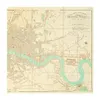
Adair, JohnA New and Exact Map of the River Clyde
Lyon & Turnbull
28 Feb 2026
🔒
Ortelius, AbrahamScotiae Tabula
Lyon & Turnbull
28 Feb 2026
🔒
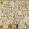
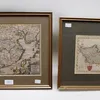
Speed, John Bohemia
Lyon & Turnbull
28 Feb 2026
🔒
O-Edo ezu, Tokugawa era map of Old Edo [Tokyo]--Nagasaki, Ohata Bunjiemon, 7th Year of An'ei era [1788]--ROBERT DE VAUGONDY (GILLES) L'Empire du Japon, 1750 (3)
Bonhams
17 Dec 2025
🔒
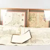
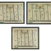
MAPS - John SPEED (1552-1629). Holy Iland ... Garnsey ... Farne ... Jarsey, [London], 1610 [but 1611 or later], engraved map, 380 x 510mm., framed and glazed. With 15 other engraved maps and charts, f…
Bellmans
3 Dec 2025
🔒
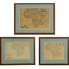
MAPS OF AFRICA: 1- Dapper, Olfert: Africae Accurata Tabula
Sworders
1 Dec 2025
🔒
, C: Essexiae Comitat' Nova vera ac absaluta Descripto, 1576.
Sworders
1 Dec 2025
🔒
, TWO MAPS: 1- Speed, J: Essex divided into hundreds
Sworders
1 Dec 2025
🔒
Maps: LONDON WARDS (All hand coloured)
Sworders
1 Dec 2025
🔒
Engraved Maps, including two Robert...
Tennants
21 Nov 2025
🔒
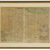
Cary's Actual Survey of the Country Fifteen Miles round London, FIRST EDITION, 1786; and another
Bonhams
19 Nov 2025
🔒
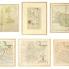
A Complete Atlas of the English Countiess, FIRST EDITION, 1822
Bonhams
19 Nov 2025
🔒
Political Essay on the Kingdom of New Spain Containing Researches Relative to the Geography of Mexico, the Extent of its Surface and its Political Division into Intendancies, vol. 1-2 (of 4) and Atlas…
Bonhams
19 Nov 2025
🔒
MOGG (EDWARD) London in Miniature with the Surrounding Villages. An Entire New Plan... Accompanied by... a Separate Index, Edward Mogg, 1842; Index to Mogg's New Plan..., 16pp., original plain wrapper…
Bonhams
19 Nov 2025
🔒
A New Pocket Atlas and Geography of England and Wales, FIRST EDITION, 1803
Bonhams
19 Nov 2025
🔒
WALLIS (EDWARD, publisher) England and Wales, Shewing All the Principle Roads, Rivers, and Railways, E. Wallis, 1830s
Bonhams
19 Nov 2025
🔒
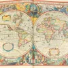
Atlas, ou Representation Du Monde Universel...Edition Nouvelle, 2 vol., Amsterdam, Henricus Hondius, 1633
Bonhams
19 Nov 2025
🔒
A New General Atlas of the World, Henry Teesdale, 1841
Bonhams
19 Nov 2025
🔒
of Assorted Maps, including Saxton...
Tennants
22 Aug 2025
🔒
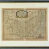
SPEED, John (1552-1629). Hantshire described and devided, London: [c.1676], hand-coloured engraved map of Hampshire, inset bird's-eye-view of Winchester, coats-of-arms, 375 x 505mm., framed and glazed…
Bellmans
16 Jul 2025
🔒
SPEED, John (1552-1629). Oxfordshire described, [London, 1676], hand-coloured engraved map, inset bird's-eye-view of Oxford, 18 college coats-of-arms in the borders (some light staining at the centref…
Bellmans
16 Jul 2025
🔒
SPEED, John (1552-1629). Sussex described, [London], George Humble, [c.1627], hand-coloured engraved map of Sussex, inset bird's-eye-view of Chichester (browned, trimmed close to engraved frame, repai…
Bellmans
16 Jul 2025
🔒
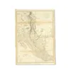
The Gulf of Anville, Chinese Tartary (Manchuria)
Bonhams
15 Jul 2025
🔒
Speed (1860-1931)
Sworders
20 May 2025
🔒
's Reduced Engraving of the Original Plan of Oxford
SAS
1 Apr 2025
🔒
collection of John Speed maps
Sworders
4 Feb 2025
🔒
THOMAS BADESLADE (BRITISH, ACT. 1719-1750) (2)
Bellmans
13 Jan 2025
🔒
A Great Western Railway and Connections
SAS
29 Oct 2024
🔒
Jefferys (1723-1805)
Sworders
8 Oct 2024
🔒

JOHN SPEED
Bellmans
9 Sep 2024
🔒
Two 18th Century black and white maps of Germany and Empire of Prussia, by T.Kitchen.
Hansons
15 Aug 2024
🔒
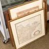
antique framed paper maps
SAS
6 Aug 2024
🔒
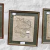
Maps: Blome, Richard (English, 1635-1705), a hand coloured engraved county map titled "A Mapp of the County of Suffolk with its Hundreds"., dedicated to Thomas Tymperley, circa 1673, framed approx 28
Hansons
18 Jul 2024
🔒

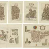
[Maps] A folio of loose unframed mainly 17th Century maps to include: 1. pp 145 and 146 book plate to include strip road map of Hereford and Shropshire with Arms of Ludlow and The Deanary of Chester,
Hansons
18 Jul 2024
🔒
[Maps] A folio of loose unframed mainly 17th Century maps to include: 1. pp 145 and 146 book plate to include strip road map of Hereford and Shropshire with Arms of Ludlow and The Deanary of Chester,
Hansons
27 Jun 2024
🔒
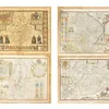
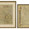
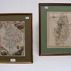
[Maps] Four three hand coloured engraved county maps to include: 1. Speed, John (1552-1629) & Hondius, Jodocus (1563-1612), The Countie of Nottingham described The Shires Townes Situation And The Ear
Hansons
27 Jun 2024
🔒

Maps: Blome, Richard (English, 1635-1705), a hand coloured engraved county map titled "A Mapp of the County of Suffolk with its Hundreds"., dedicated to Thomas Tymperley, circa 1673, framed approx 28
Hansons
27 Jun 2024
🔒
Maps: Ogilby, John (Scottish 1600-1676), three framed road strips maps. circa 1675, to include: 1. The Road from London to Weymouth, Map no 53 2. The Road from London to Yarmouth, Map no 54 3. The Roa…
Hansons
27 Jun 2024
🔒
[Maps] Suffolk: Smith, William - A New Mapp of the County of Suffolk with the Post & Cross Roads & other remarks, according to the latest & best observations, pub. Henry Overton, 1713, double page han…
Hansons
27 Jun 2024
🔒
A collection of framed 18th Century maps of Huntington.
Hansons
16 May 2024
🔒
Two 19th Century maps of Nottinghamshire and Huntingdon.
Hansons
16 May 2024
🔒
Two 18th Century maps in frames, one of China and one of Berkshire.
Hansons
16 May 2024
🔒
's Map of Berkshire
SAS
14 May 2024
🔒
Robert Morden engraved and hand-coloured map of Essex
Sworders
3 Apr 2024
🔒
Gordon, PatrickGeography Anatomiz'd
Lyon & Turnbull
7 Feb 2024
🔒
Speed, JohnEngland, Wales & Scotland and Ireland Described and Abridged
Lyon & Turnbull
7 Feb 2024
🔒
of Engraved Maps of Cumbria...
Tennants
12 Jan 2024
🔒
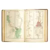
Speed, John and Peter Keer[Volume of miniature maps of Scotland and Ireland]
Lyon & Turnbull
21 Sep 2023
🔒
The Kingdom of Ireland by Robert Morden
SAS
8 Aug 2023
🔒
Kingdom of Ireland by Robert Morden
SAS
8 Aug 2023
🔒
Blaeu, Joannes[Theatrum Orbis Terrarum: Volume V] - Scotia, quae est Europae Liber XII [Scotland & Ireland]
Lyon & Turnbull
21 Jun 2023
🔒
Speed, JohnBritain, as it was divided in the tyme of the Englishe Saxons...
Lyon & Turnbull
21 Jun 2023
🔒
Speed, JohnCambridgshire
Lyon & Turnbull
21 Jun 2023
🔒
Maps of Northumberland, Lancashire,...
Tennants
26 May 2023
🔒
of the Americas Eight engraved maps,...
Tennants
13 May 2023
🔒
Isles Maps Nouvelle Carte D'Angleterre...
Tennants
13 May 2023
🔒
Scottish mapsA collection
Lyon & Turnbull
13 Jul 2022
🔒
Speed, John - Keere, Pieter van denA Prospect of the Most Famous Parts of the World
Lyon & Turnbull
13 Jul 2022
🔒
Thomson, JohnThe Atlas of Scotland
Lyon & Turnbull
13 Jul 2022
🔒
Two atlases19th century
Lyon & Turnbull
13 Jul 2022
🔒
About These Prices
Compiled from recent results across Dreweatts, Bonhams, Hansons, Chiswick Auctions, Special Auction Services, Sworders, Tennants, Cheffins, Bellmans, and Lyon & Turnbull. Hammer prices excluding buyer's premium. Price ranges are based on the 10th–90th percentile of recorded sales — unusually high or low results are excluded to avoid skewing the range.